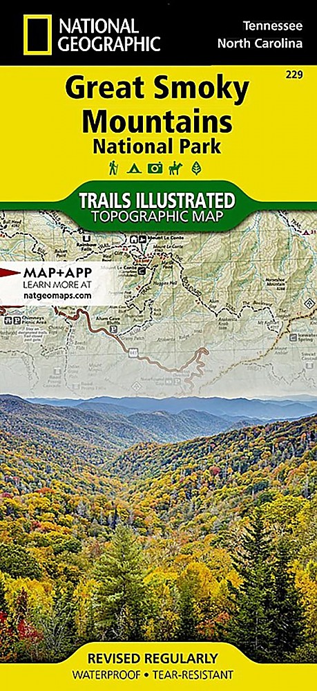
National Geographic Great Smoky Mountains National Park Map


![]() Reviewed by
Reviewed by
Jim O'Hagan
+30
 August 13, 2016
Great for driving and planning, not really a hiking map.
Pros
- Large tear-resistant color map with good resolution
- Folds easily for car or daypack
- Includes roads nearby but outside National Park
Cons
- No real info on trailheads
- No closeups of Gatlinburg or other city streets
Map number 229. This is a great map for planning a trip to the Smokies, and useful to use with a hiking guide or trip advisor to find certain locations in the park. It is also great for driving around to know where you are and where you are going.
It does show many marked trails, but isn't really a hiking map. One side shows the east side of the park, the other side the west side, with about 5 miles of overlap. 50 foot elevation contours don't drown out the other features. Shows waterfalls, marinas, viewpoints, etc. 1:70,000 scale.
Source: bought it new
Price Paid: $9.38
Your Review
Where to Buy
You May Like
Specs
| Price |
MSRP: $11.95 Current Retail: $14.95 Historic Range: $9.55-$14.95 Reviewers Paid: $9.38 |