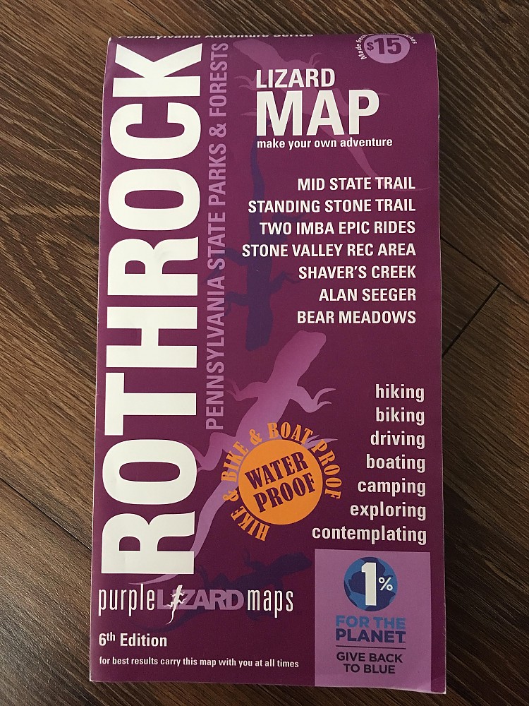
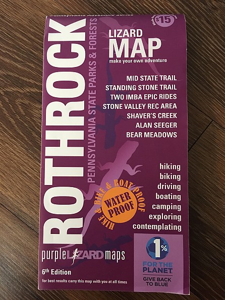
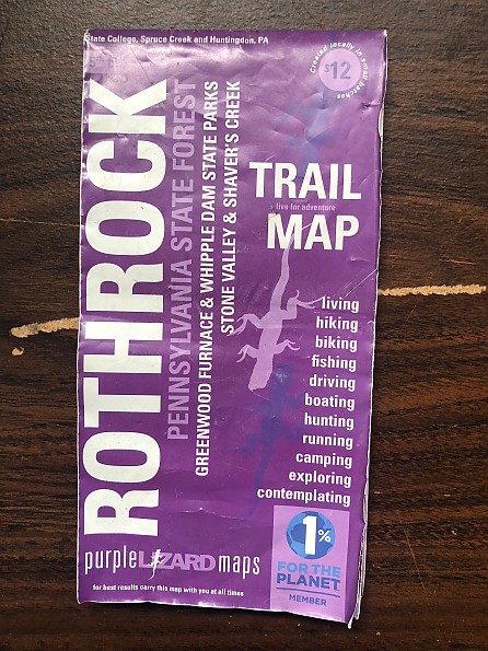
Purple Lizard Maps Rothrock State Forest Trail Map


 Reviewed by
KiwiKlimber
TOP 10 REVIEWER
REVIEW CORPS
+9,341
 January 14, 2019
A hardy map that can withstand punishment and inspire exploration. The Purple Lizard Rothrock State Forest map thoroughly covers the forest, as well as areas north and south of the forest boundaries. Best for folks living in or looking to explore Central Pennsylvania, or for people who really like maps, I suppose.
Pros
- Waterproof
- Highly durable
- Easy to read
- Highlights like-minded local businesses
- The company’s signature hidden purple lizards scattered throughout the map (signifies a cool spot, but doesn’t tell you what it is...makes for a fun surprise).
- Additional trip-planning resources on company's website
- 1% For the Planet member
Cons
- Pretty big and bulky
- Area business ads take away from the map
Usage:
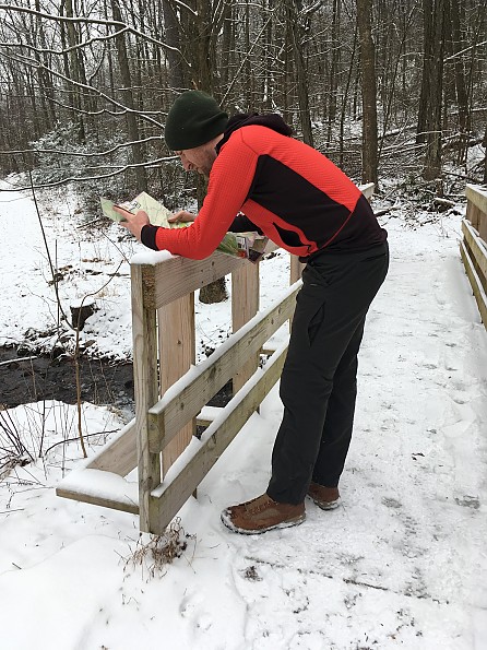
I own other Purple Lizard maps, but this one gets the most use, as the Rothrock State Forest and surrounding areas are pretty easy to explore via hiking, camping, biking, hunting, and fishing.
The double-sided map covers the entirety of the mountainous Rothrock State Forest and its many trails, and also includes:
- Five nearby natural areas (Bear Meadows, Detweiler Run, Alan Seeger, Rocky Ridge, and Little Juniata)
- Two state parks (Whipple Dam and Greenwood Furnace)
- PA State Game Lands, including their specific ID number (very helpful).
- Other cool places to explore like Penn State University’s Stone Valley Recreation Area and the ever-popular Mount Nittany.
While it takes away from the aesthetic of the map, the area business ads on the map tend to be local businesses that are tailored to the outdoor industry (gear shops, bike parts stores, breweries, etc.). I’ve actually found a couple new places to grab a meal/drink after a hike because of these ads, but I wish they were more orderly placed (i.e. all aligned on the bottom) and not strewn across the various edges.
Material:
The map is made of some sort of plastic that folds easily and feels more like paper. Being plastic means that it is waterproof (it is, I’ve learned on a few occasions) and one needs not worry about it when cramming it in and out of your pack a few hundred times (also, as I’ve learned on a few occasions). It does lose some of its pliability when subjected to sub-freezing temps, but not so much that it will break (maybe at Arctic temps, but I'm not going to be testing it to find out).
Size:
- Unfolded: 24" x 36"
- Folded: 4" x 8"
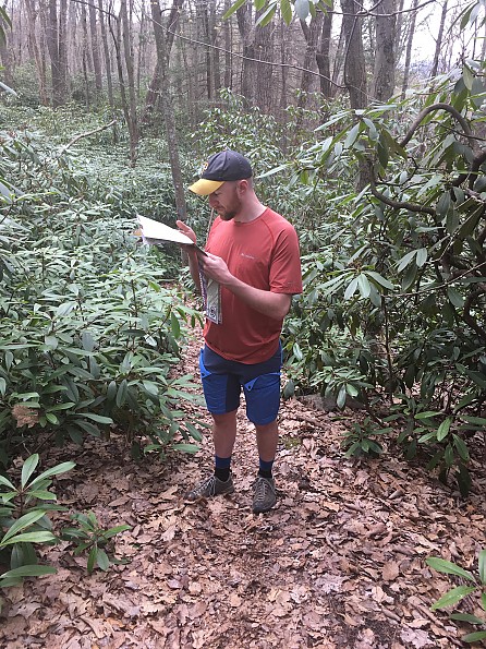
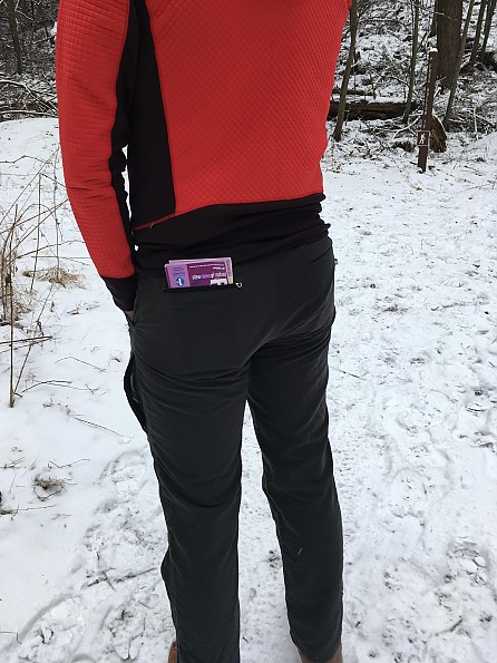
This makes for a pretty large map when fully unfurled, but at least it slides into the back pocket of most pants I own when folded down, making for easy access on the trail.
What’s a purple lizard?
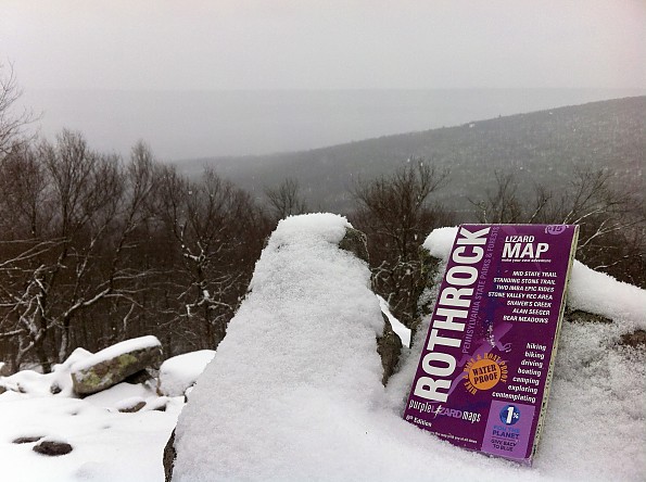
I have no idea what a purple lizard is, but what I do know is that the manufacturer places little purple lizards throughout their maps to indicate a cool spot to check out. This could be anything really, from a nice secluded view of a nearby valley to a local legend spot. Those little lizards draw me in whenever I’m nearby and I can’t help but go find out what is there. Most of the time, they are not in high-traffic areas that everyone knows about already, which I appreciate. The little lizards are a great touch that can only be accomplished by mapmakers who know the area well.
Bonus Info:
In addition to making great maps, Purple Lizard also posts easy-to-read hikes and adventures on their website that correspond to trails on the map. For example, here is a post about the Ironstone Trail, which is located on the Rothrock State Forest map. This credible, first-person account really helped me when planning to hike the same trail.
Recommendation:
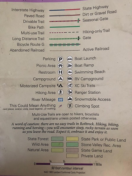
The Rothrock map is a great go-to resource for exploring Central PA. The area it covers is too big for step-by-step and minute details, but the legend, or as the manufacturer calls it, “Explanation of Symbols” is easy to grasp and helpful, including things like major trails, shared-use and hiking only trails, parking areas, even abandoned railroads (yep, there are a lot of those in PA) and much more. The additional trail-related information that can be found on the company’s website makes trip-planning even easier.
Simply put, it’s a great map that won’t wear out.
Background
I've always preferred physical maps as opposed to digital versions (apps). Typically, I take at least one map with me on most trips. I've been using Purple Lizard maps for 5 years, ever since moving to Central Pennsylvania and this one, by far, gets the most use. I've owned older editions of this map, with the most current being the 6th Edition.
Source: bought it new
Price Paid: $15
 Reviewed by
Bruce Etter
+326
 September 27, 2018
Not all maps are created equal. This map does everything you need and more. It encourages exploration to a degree that is impressive. I buy this map every time it is updated and would encourage anyone who spends any time in Central Pennsylvania to grab a copy.
Pros
- Creative and thoughtful design
- Clear and legible markings
- Inspires you to explore new places and create your own loops
- Durable
Cons
- Cumbersome when unfolded
- Covers a comparatively small area (215,500 acres)
While no product is ever perfect, Purple Lizard Maps has created a map that is close as you can get. The Rothrock State Forest map is a fabulous bundle of knowledge that includes information related to hiking and biking trails, fishing holes, climbing areas, and much more within Rothrock State Forest and the surrounding area. In addition to detailing specific activity use trails the map also is color coded to show land type (state forest, wild area, private land, etc.). Contour intervals are presented at a 50-foot interval and latitude and longitude marks border of the map.
While all of those features are essential to any good map, what sets this map apart is the purple lizards that dot the trails and roads within the confines of the map. Purple lizards are defined in the legend as follows: "this could mean anything (cool place, scenic vista, local legend... or nothing)." I have an untold number of stories about the incredible things I have seen and experienced at these lizards from the stump-tap (a stump with a beer tap on in) to views of rolling hills that melt into the horizon. Once you "get" your first lizard, you will want to experience the rest.
Whether you are a weekend-warrior day-hiker, someone who is considering a long-distance hike on the Mid-State Trail, or Joe and Jane Shmo looking to for a visually appealing drive, this map will get you to where you need to go. The material the map is printed on is of the highest quality and can be submerged in water and folded a hundred times over before signs of wear begin to accumulate.
The creators of the map took the time to put some humor into their product ("for best results carry this map with you at all times") which I think deserves praise. Additionally, they are members of 1% for the Planet, so you know that they are conscious environmentalists.
If you ever visit State College or the surrounding area, do yourself a favor and drop the twelve dollars for this map.
Below: folded map
 Below: map with hand for size comparison
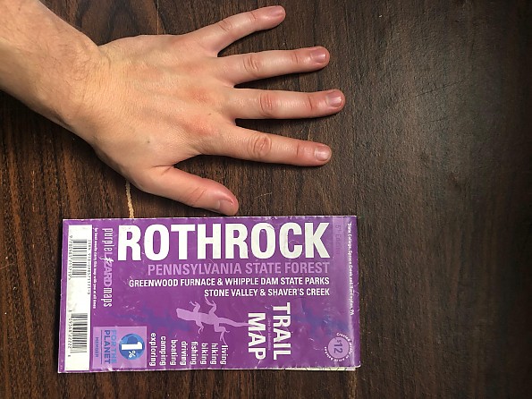
Below: legend of map. Be sure to look at the purple lizard.
Below: Unfolded map with tape measure. The map is approximately 36" by 24"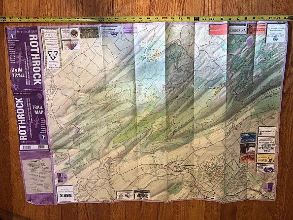
Source: bought it new
Price Paid: $12
Your Review
Where to Buy
You May Like
Specs
| Price |
MSRP: $15.00 Historic Range: $12.00-$15.00 Reviewers Paid: $12.00-$15.00 |