 by Alicia MacLeay
(Continued from Part One)
On June 21, 1934, the four Bates boys, as I come to think of them—Professor William Sawyer, outing club president Sam Fuller ’35, Harold “Ace” Bailey ’36, and Edward Aldrich ’35—set off into the Maine woods laden with 45-pound packs and a direct mission from ATC chairman Myron Avery: scout a path for the Appalachian Trail from Frye Bridge in Andover to the base of Saddleback Mountain near Rangeley, some 22 miles away (as the crow flies). If the group could locate, flag, and map a viable route through this area, scouting for the footpath would be completed from Maine’s Mount Katahdin to Georgia’s Mount Oglethorpe.
For navigation the Bates Outing Club group had a map, which they’d eventually determine was “all out of proportion,” an altimeter and compass, and potential route descriptions passed on by Avery, local wardens, and Maine Forest Service supervisor Robert Stubbs, with whom Sawyer and Sam had met prior to the trip. They gave themselves a week to scout this final missing section of trail when they started off from Sawyer Brook in Andover up a very muddy tote road—the one described in the students’ trip log as “worse than the Bad Lands in South Dakota after a week’s rain.”
My husband, Dave, and I have decided to do the same trip in three days.
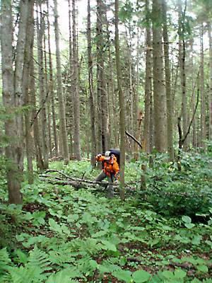
The author bushwhacking up the the east side of Wyman Mountain.
Looking at the maps and route descriptions at home it seems as simple as connecting one old trail, tote road, or path to the next, with a little bushwacking thrown in here and there for fun. We’re fully equipped with accurate topographic maps, a loaded GPS, trail descriptions from the 1936 and 1938 Guide to the Appalachian Trail in Maine, and a copy of the 1934 trip’s scouting log. Unlike the Bates group, we already know where we’ll be going, and won’t need to spend time scouting the route as they did. And to top it off, it’s 73 years later. We’ve got lighter, faster gear (see our gear list). We are prepared.
On June 20, 2007, we start off from Sawyer Brook, in a light rain. Over the next two to three miles the light rain becomes a full rain, which does nothing to deter the mosquitoes, and the gently winding dirt road, at first dotted with camps, gradually becomes narrower and steeper until it’s a rough, muddy, overgrown tote road along Moody Brook and Wyman Mountain and finally nothing but a wet herd path. As I make my way uphill I step over and into frequent piles of moose droppings hidden in the tall wet grass and ferns.
Since I first read my great-uncle Sam’s college trip log a decade ago I’ve wondered what this trip to finish the AT meant to him and his friends, but I never had the chance to ask. Now I’m finally following his path, a circuit of tote roads, forgotten trails, logging roads, bushwhacks, and even the current AT. I feel a sense of adventure at this journey of family and hiking history, a quest you wouldn’t find in any guidebook, which makes it all the more interesting.
My soaking wet feet also raise a suspicion about what “worse than the Badlands after a week of rain” actually means.
The old tote roads and paths we start out on pass through a young forest, now leafy and dense. It’s no longer raining, but I’m in the lead and with every step droplets of water shake onto me from overhanging limbs and tall grass. In 1934 logging operations were at a peak here and the tote roads were in full use. The Bates group passed two logging camps nearby. They reached the first, after a mile or so of climbing uphill, to discover they’d started off on the wrong trail. “Just one of life’s little tragedies,” the students would write in their trip log.
Rather than turning back, they continued on and at the second logging camp opted to stay the night. There they were given a brand new cabin to sleep in and served “real logging chow and were darn glad to get it”—baked potatoes, boiled eggs, baked beans, apple sauce, roast pork, biscuits, roast beef, doughnuts, cookies, cake, apple pie. The next morning the logging camp boss led them over Wyman Mountain, from which they dropped west toward Surplus Pond and back onto their intended route.
Logging camps weren’t only good for a hearty meal, a warm bed, and directions. They were an integral part of completing the AT in Maine. While Maine lacked hiking trail systems in its North Woods, that didn’t mean its forests were unexplored. Logging camps had been used in the Maine woods since the 1820s and by 1832 Bangor was the largest shipping port for lumber in the world. To expedite the process of completing the AT, whenever possible Avery’s original route utilized the logging industry’s network of tote roads, as well as any existing trails and paths. When necessary the most direct path between two routes would be cleared.
Often scenic peaks and ponds were bypassed in favor of less scenic, but more convenient, routes. Environmental impact wasn’t even a consideration. In later decades large portions of the Appalachian Trail would be relocated as design, construction, and trail maintenance standards evolved. Nearly three-quarters of Maine’s 260 original trail miles east of Grafton Notch were eventually relocated, resulting in a more remote and attractive hiking experience, and miles of abandoned trail. But in 1934, Avery’s priority was simply to get the Appalachian Trail to Katahdin as a continuous footpath, and he took the path of least resistance.
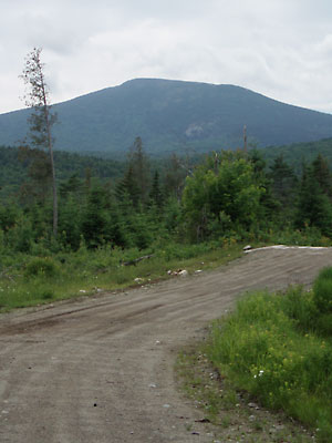
Baldpate Mountain looms over Burroughs Brook Road, a still-active logging road which was scouted by the Bates group and became part of the original AT route.
After gaining the ridge between Hall and Wyman mountains, we hike south on a section of the current AT. After dropping our packs at Surplus Pond, as did the Bates boys, we head the three miles down Burroughs Brook Road to the Andover-Upton Road and Frye Bridge, the true start of this section of the original AT. “I would suggest that you make your western terminus Frye Brook,” wrote Avery to Sawyer just before the trip.
At Frye Bridge the Bates boys bought lunch (25 cents) at a small logging camp, now a private cabin. While Dave checks out the small gorge formed by Frye Brook and the trail south toward Grafton Notch, I take a peek in the window of the cabin (no one’s at home) and think of Sam and his companions eating their lunch of meat, potatoes, and dessert inside. Then we turn around and head north back up Burroughs Brook Road toward Surplus Pond.
We are on the original AT, but it is nothing like the AT I know. It is a wide, dusty, dirt road occasionally scattered with flattened frogs and shotgun shells and branching off to a long series of logging yards, open and ugly and littered with brush and graying wood chip debris.
After scouting this area seven decades ago Sawyer would write to Avery, “the International Paper Company and Brown Company have started in wholesale lumbering operations through this whole section, and any trails which we lay out are likely to be sadly disarranged in the next year or two.” The logging camps may be gone, but they’re still logging here periodically and the AT no longer follows this route.
Understandably, some logging companies had their own concerns about hikers and their fires passing through their valuable natural resources. According to the state forest service, during the summer of 1934 heavy fires were running rampant in other parts of Maine, including a fire that was consuming 30,000 acres west of Millinocket, south of Katahdin.
“I told Mr. Sawyer that we were still a little in the dark as to the attitude which the Brown Company might take,” wrote Maine Forest Service supervisor Stubbs to Avery days before the Bates trip. “They are going into the country and be very careful of fires and avoid creating any comments.”
Despite Stubbs’s concern, the Bates group appears to have gotten on well, repeatedly connecting with and receiving assistance from logging camp bosses and fire wardens, locals who knew the land and the location and condition of a good trail or road.
As we trudge up this logging road I wonder: would the Appalachian Trail initially have made it through Maine, supposedly the wildest section and biggest challenge of the whole project, without the logging industry’s access roads, fire warden trails, and local knowledge?
By dinnertime we’re back with our packs on the edge of Surplus Pond, eating our rehydrated pasta and potatoes (surely just as tasty as fresh donuts and pie), drying our feet, and watching a deer drink from the opposite shore. We’ve covered at least 13 miles so far and I’m feeling confident, despite a hotspot on my right foot. After that six-mile road walk I begin to think we might breeze through this.
All day I’ve had a rare sense of adventure. Sure I’ve hiked and backpacked in lots of beautiful places, but this is different. We’re on our own trail. Every time I’m buoyed up I think of Sam and his fellow college scouts, young men of 20 years old, off on their own adventure. I hope they felt the same. I hope that they were excited about their role in completing the AT and had an inkling of what the trail would mean to generations of future hikers, even if one of them, Sam, wouldn’t live long enough to hear about the first documented thru-hike of the AT in 1948, four years after his own wartime death.
Tonight we’ll make camp at C Pond, three miles away (at least as the crow flies). We just need to connect some old paths, trails, and tote roads through the woods along Mountain Brook and down to the shore of C Pond, where the Bates boys spent their second and third nights at a warden’s cabin.
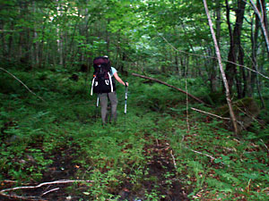
The author sets off on a muddy, overgrown tote road north of Surplus Pond.
The old, new, and long forgotten logging roads and paths that crisscross our route are both a boon and a bane to navigating and trail going. We backtrack, recheck maps, the GPS, trail descriptions. A path looks like the one on our map that once led to the next waypoint, but a half mile later winds us back around in the wrong direction. Another peters out until we’re standing waist high in unripe berry bushes staring at a perfect bear paw print in the patch of mud at my feet. And it’s a large bear paw print, as all are at dusk when you’re miles from camp.
You just don’t know. This is my new refrain.
You just don’t know about a trail until you follow it. You can connect the dots on all the maps, read the logs and trail descriptions, but if you’re walking through logging country, there will inevitably be trails that appear on no map while the one trail junction you’re looking for, the one the GPS says is right here where you’re standing, will not appear.
The Bates group understood this. Sure, they brought their maps, compass, and altimeter, and apparently were quite handy navigators. But they also knew the importance of first-hand knowledge. Several times on their scouting trip they found themselves searching for a rumored trail without luck, including in this very section between Surplus and C ponds, only to be shown the path the next day by the person who cleared it.
As we continue to check and correct our route, angling (hopefully) closer toward C Pond, I begin to understand why the Bates group was forced to change course through this “dismal swampy area” and why it “required an enormous amount of intestinal fortitude, one member of the party having a slight attack of biliousness.” That confident dinner on the shore of Surplus Pond feels long ago. It doesn’t help that my socks are once again soaking wet or that it’s getting dark. I wonder who got irritable in the Bates party. I wish I’d paid a little more attention to their brief mentions of mud and swamp and less to the lengthy descriptions of what they ate.
Unable to find our trail, or any one in the right direction, we bushwhack north toward Mountain Brook. The off-trail going is actually easier than the rough remains of the tote roads we’ve been following and after crossing north of the brook we intersect a more recent logging road that leads down toward the pond. It’s nearly dark when a moose steps out on the road ahead of us, looking back every few seconds to check us out as we slow to keep our distance. She finally lumbers back into the trees when suddenly a medium-size black bear bursts from the undergrowth, runs across the road and up the hill on the opposite side. We pause to listen to the bear crashing upward through the vegetation and then gingerly continue on our way.
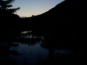
Twilight settles over C Pond.
We make it down to the eastern end of C Pond after dusk and set up camp in the dark after nearly 20 miles of hiking. When Sam arrived on the shore of this small lake it was the evening of his 21st birthday, and Warden Learned had prepared a “veritable banquet” in his cabin for the small party. For the Bates boys it was yet another night of camaraderie and feasting, a good way to end a day on the trail.
Despite the logging roads and trails, we haven’t seen or heard a soul all day, at least not a human one. And I’m glad. From inside our tent we hear a loon call softly on the lake and later an owl in a tree.
Continued in “Blazing a Good Trail: The AT in Maine” (Part 3)


