Guidebooks
Top Picks
How we choose: The best guidebooks highlighted here were selected based on 24 reviews of 20 products. Our top picks are those that are readily-available in the United States and have received the highest overall ratings from reviewers.
How we test: Trailspace is powered entirely by our community of readers. The reviews posted here reflect the real-world experiences of outdoor enthusiasts just like you.
If you've used a guidebook that you think should be listed here, please share your experience.
Disclosure: Trailspace never accepts payment for gear reviews, product placement, or editorial coverage. When you buy through affiliate links on our site, Trailspace may earn a small commission, which helps cover the costs of running the site.
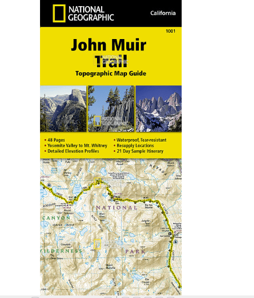
National Geographic John Muir Trail Topographic Map Guide
 Reviewed
by Bill S
Reviewed
by Bill S 
If you are contemplating thru-hiking the John Muir Trail (or any section of it), this John Muir Trail Topographic Map Guide does an excellent job of gathering all the needed information for planning, plus having detailed maps of the entire trail and surrounding terrain.
Reasons to Buy
- Detailed map guide to the John Muir Trail
- Small size (fits in pocket of shell jacket)
- Lightweight compared to other options
- Waterproof and tear resistant
- Accurate mileages to waypoints along the trail
- Includes resupply points with shipping info
- Includes trail profiles
Reasons to Avoid
- Information on permit procedure is somewhat sparse (need to go online to get details)
- Details are tiny, requiring good eyes or better glasses for us old geezers
- Grid is UTM/MGRS, so the Mercator flattening produces some distortion that lat/lon would reduce
Comparison of size of National Geographic Yosemite map with the John Muir Trail Topographic Map Guide (USGS 1:250,000 map in background) Background: I have to confess up front that, despite having hiked and climbed on all seven continents, including fairly extended expeditions (both time and distance), and having lived in California for a total of roughly 50 years (minus short sojourns in Massachusetts and Mississippi), I have not thru-hiked the entire length of the John Muir Trail, although I have hiked major portions.
Read more: National Geographic John Muir Trail Topographic Map Guide review (1)
That Wild Country: An Epic Journey through the Past, Present, and Future of America's Public Lands
 Reviewed
by KiwiKlimber
Reviewed
by KiwiKlimber
A down-to-earth book that is one part adventure journal and travelogue and one part approachable history lesson on public lands in the United States. The author skillfully weaves personal stories of adventures on public lands with the long and winding history of the public lands themselves. A great read for any adventurer, public lands user, or public lands advocate.
Reasons to Buy
- Vividly descriptive writing
- Well-researched
- Describes relatable and approachable trips
Reasons to Avoid
- Colorless, small photos
A book about public lands, sitting on a public lands map, next to a public lands cup of coffee. Details: Author: Mark Kenyon Length: 282 pages Publisher: Little A Publication Date: 2019 Review: While the author, Mark Kenyon, is most recognized as a prominent voice in the deer hunting culture (founder of Wired to Hunt website and podcast, as well as a prominent contributor to MeatEater), he shouldn’t be pigeonholed as just a hunter. This book clearly illustrates Kenyon’s diverse outdoor interests and describes some of his memorable trips hiking, fly fishing, camping, pack rafting, sightseeing, and RVing, with only two short tales of hunting trips mixed in.
Read more: That Wild Country: An Epic Journey through the Past, Present, and Future of America's Public Lands review (1)
Westwater Books Belknap's Waterproof Canyonlands River Guide
 Reviewed
by BigRed
Reviewed
by BigRed 
A classy, cargo pocket-sized, waterproof guide to over 350 miles of the Green and Colorado Rivers through and above Canyonlands National Park, with detailed maps, illustrations, and text on the region’s colorful geology and history. Works well as a stand-alone guide for river trips.
Reasons to Buy
- Nicely rendered maps with plenty of detail on the river and immediate surroundings
- Overview of regional geology and river history
- Maps augmented with photos, notes, and quotes from explorers
Reasons to Avoid
- No info on water sources
- No mention of Native American history
- Lake Powell map is an afterthought
In the winter of 2018, during our year-long residence in Tuscson, my wife and I decided to splurge on a 6-day guided raft/dory trip on the Colorado River from near Moab, Utah, down through Cataract Canyon in Canyonlands National Park to the uppermost reach of Lake Powell. The rafting company, OARS, threw in a copy of this Belknap River guide for the same price as you’d buy it anywhere else, and sent it on ahead to give us something to read or maybe just drool on—good thing it’s waterproof.
Read more: Westwater Books Belknap's Waterproof Canyonlands River Guide review (1)
Down East Books Hiking Maine's 4,000-Footers
 Reviewed
by LoneStranger
Reviewed
by LoneStranger 
Hiking Maine's 4000 Footers is a guide book with detailed descriptions for day hiking each of Maine's 14 high peaks. Doug Dunlap has authored several other books on Maine hiking and includes a lot of basic hiking info for newer hikers in this guide.
Reasons to Buy
- Accurate trail descriptions
- Lots of basic info for newer hikers
- Small reference maps
Reasons to Avoid
- Some repetitive text
- No elevation profiles
Doug Dunlap has written several books on hiking and snowshoeing in Western Maine. Doug is a Registered Maine Guide and he's been hiking for over 40 years in New England, hitting all 67 4k summits. In Hiking Maine's 4,000 Footers he takes on the 14 high peaks in the state. He follows the spine of Maine's mountains from Old Speck northward over Saddleback, Abraham, Spaulding, Sugarloaf, Reddington, the Crockers, the Bigelows & finally the three high peaks of Baxter State Park, N Brother, Hamlin and Baxter Peak on Katahdin.
Read more: Down East Books Hiking Maine's 4,000-Footers review (1)
Falcon Guides Paddling America: Discover and Explore Our 50 Greatest Wild and Scenic Rivers
 Reviewed
by Twig
Reviewed
by Twig
“Paddling America: Discover and Explore Our 50 Greatest Wild and Scenic Rivers” showcases some of the best paddling experiences in the USA. It also aims to increase awareness for the conservation and protection of natural river systems, with a focus on these designated rivers, protected under the 1968 Wild and Scenic Rivers Act. The 50 featured rivers span the country but are most heavily concentrated in the Pacific Northwest, California, Idaho, Wyoming, and Montana regions. Many of the rivers involve class III or larger rapids that should only be undertaken by experienced whitewater paddlers, but there are several rivers suitable for an easy canoe float. Thus, paddlers of all experience levels can find something of value from this book. Described trips range from day paddles to multi-day or even week-long trips. I was captivated by the descriptions and color photos of rivers I had never heard of and hope to ride at least a few of them someday soon.
Reasons to Buy
- A useful planning resource, providing details on access, permits, difficulty, and natural history
- Pictures and basic color maps in each chapter
- A few sidebars and famous quotes expand on related topics.
Reasons to Avoid
- Not a stand-alone guide, especially for some of the longer paddles.
- The featured Wild and Scenic rivers are heavily concentrated in the western half of the country.
General Information: Paddling America: Discover and Explore Our 50 Greatest Wild and Scenic Rivers Authors: Susan Hollingsworth Elliott & Adam Mills Elliott Publisher: Falcon 2018 Pages: 294 Size: 9 x 7.5 inches About the Authors: This book is the contribution of a husband/wife team that traveled around the country in their RV for several years with the sole focus of paddling most, if not all, the rivers detailed in the book. The duo have extensive experience in paddling, having been guides, instructors, and contributors to magazines and guidebooks, both domestically and abroad.
Read more: Falcon Guides Paddling America: Discover and Explore Our 50 Greatest Wild and Scenic Rivers review (1)
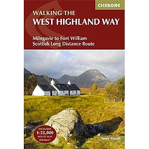
Cicerone Press Walking the West Highland Way
 Reviewed
by Charles Polidano
Reviewed
by Charles Polidano
Compact and lightweight, yet it comes with a protective plastic cover and a map booklet reproducing Ordnance Survey mapping for the entire route. Sets the standard for other guidebook publishers.
Reasons to Buy
- Compact
- Lightweight
- Encased in plastic cover
- Includes map booklet
Reasons to Avoid
- Route description could do with more detail occasionally
- Few photos of the route (as opposed to trail landmarks)
This guidebook is compact at 7 x 4.75 inches The contents of this Cicerone Press guidebook by Terry Marsh are fairly standard. There is a description of the route with 1:100,000 maps, as well as historical and general information about the towns, villages, and other landmarks that are encountered along the way. The guidebook breaks the route down into seven stages for the purposes of its detailed route description. But a table near the start of the book indicates how the route can be broken down into six, eight, or nine days.
Read more: Cicerone Press Walking the West Highland Way review (1)
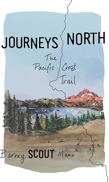
The Mountaineers Books Journeys North: The Pacific Crest Trail
 Reviewed
by Mary Beth Skylis
Reviewed
by Mary Beth Skylis
Famous trail angel Barney "Scout" Mann takes readers through a riveting portrayal of his experience on the Pacific Crest Trail.
Reasons to Buy
- Captures trail family dynamics
- Written with eloquence
- Lighthearted yet honest
- One of the most accurate portrayals of thru-hiking
Reasons to Avoid
- There are many characters to track
In 2007, hundreds of eager hikers kicked up dust from the Mexico monument as they set foot on the Pacific Crest Trail. Among them were Barney "Scout" Mann and five other hikers he encountered along the way. In Journeys North, Scout includes snippets about trail romance, culture, humor, and exploration. The eloquent narrative questions why one might hike 2650 miles along through California, Oregon, and Washington. About the Author Barney "Scout" Mann lived much of his life as a lawyer.
Read more: The Mountaineers Books Journeys North: The Pacific Crest Trail review (1)
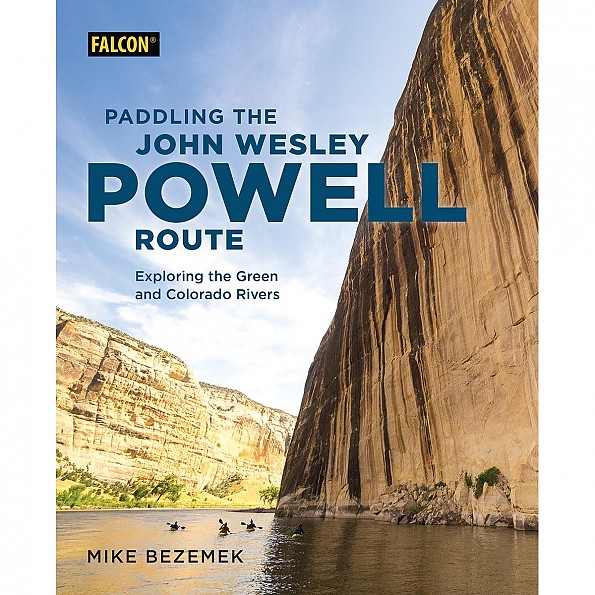
Falcon Guides Paddling the John Wesley Powell Route: Exploring the Green and Colorado Rivers
Reviewed
by BigRed
"Paddling the John Wesley Powell Route" is a meta-guidebook to 1,700 miles of river and reservoir in the footsteps (well, oarstrokes) of Powell, who led the first expedition down the Green and Colorado rivers through the Grand Canyon. It's a valuable planning resource for everything from day trips to the whole exhausting journey, but too general for day-to-day details.
Reasons to Buy
- An excellent planning resource, with info on access, permits, suppliers and outfitters, and side trips
- General info on regional geology, flora and fauna, and history
- Photos and sidebars provide inspiration and food for thought
Reasons to Avoid
- Minor errors on the natural history, and this reader could always use a little more on that front
- Not the one book you'll need to have in your boat
- Maps could offer a few more details
Aficionados of the desert Southwest know the scene: 1869. John Wesley Powell, a one-armed Civil War veteran, seated in a wooden armchair strapped to the deck of a wooden boat, sets off from the railroad town of Green River Station, Wyoming, with a hardy crew of nine other men, aiming to fill in the last blank space on the U.S. map, on rivers about which little is known except for that they drop over a mile across the unknown region. Rumor has it that the whole river just disappears into a great big hole somewhere in there, only to emerge again in the depths of the Grand Canyon.
Read more: Falcon Guides Paddling the John Wesley Powell Route: Exploring the Green and Colorado Rivers review (1)
More Reviews of Guidebooks
Trailspace reviewers have shared 24 reviews of 20 different guidebooks.
or add yours
Other Types of Books and Maps
Find more books and maps reviewed in these related categories:
Outdoor Skills Books
Maps
all Books and Maps
Review Your Outdoor Gear
If you've found this site helpful — or if we've missed something important — please consider paying it forward by some of your favorite outdoor gear.
Why? From professional gearheads to outdoor novices, everyone has an important point of view to contribute. will support the outdoor community and help others find the best gear.
Trailspace reviewers are outdoor enthusiasts like you: hikers, climbers, paddlers, backcountry skiers, and trail runners who share our experiences with the gear and clothing we rely on to get outside. Learn more about Trailspace