 by Bill Straka
Text and photos by Bill Straka
This trip report is in somewhat reverse order. The hike up Kilimanjaro is given as a narrative first, followed by the photo safari being primarily photographs with captions. My wife, Barb, and I did the safari first, due to an old knee injury that she suffered a few years back while skiing. After the safari, she returned home, while I did the hike.
Contents
The Hike
The Safari
Photos from the Safari
The Hike
Tanzanian law requires hiring local guides, cooks, and porters. So we contacted EcoTours, a local company based in Moshi (not connected with the large U.S.-based EcoTours), and used Colorado-based Adventures Within Reach as an intermediary. If you use a U.S. or European based company, you will generally be paying the overhead for their home base plus paying for one of their representatives to fly there and accompany you, in addition to the Tanzanian personnel. By going more directly, our total cost for the two of us, including airfare, was half the cost for one person through one of the major companies. Plus we were able to ensure that the porters were paid according to the scale adopted by the porters’ union.
Another thing we did to reduce costs (and to enhance our experience) was that we chose to camp during the safari, as well as my camping on the hike up Kilimanjaro. There are several levels of camping, all rather luxurious by our standards. Our choice was “Basic,” but there is a “deluxe” level, as well as several levels of lodges (up to $1,000 per night to stay at the same lodge as people like Bill Gates and Hillary and Chelsea Clinton have stayed—rather beyond our means, not to mention taste level).
Following the safari, we spent a day sorting and repacking the gear that Barb was to take home (most of the camera gear) and the gear I would take up the mountain. My gear was separated into two packs, one for the porters (limited to 15 kg, but actually was 10 kg) and one for me (11 kg, including 3 liters of water each day, lunch, rain gear, and camera gear). At 6 p.m. on December 19, Barb’s ride to the airport arrived and I met my climbing guide, Patrick. The arrangement for me was that my party would consist of my guide (Patrick), cook (Joseph), and three porters to carry all the group gear, food, and my personal pack. We also discussed my food preferences and limitations and the schedule, and familiarized Patrick with my background.
In describing the Kilimanjaro section of the trip, I intentionally use the word “hike,” though most people refer to it as a “climb.” It is a climb only in the sense that you go uphill, admittedly by a very large amount (6,000 feet at the gate to 19,344 feet at the summit, a bit over 13,000 feet net gain).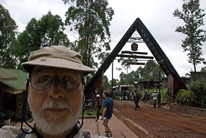 On the morning of December 20, EcoTours sent the van (the very popular Toyota HiAce) to pick me up, along with the four members of another party and our guides. A 20 minute drive, including a stop at a grocery to pick up any personal snacks, brought us to the Machame Gate and the sign-in procedures (register, sign in, show your passport—a hint for future hikers: keep your passport in a sealed ziplock bag. It rains a lot and your passport will get wet, which means the ink used by some countries to place a visa in the book will run). Then we set off up the trail (more like a road). The porters had already departed with the gear.
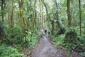
The rains started before we left the gate. We were, after all, hiking in a rain forest. After 4 hours 20 minutes, we had covered the 10.3 km and gained a total of 4,600 feet to arrive at Machame Camp, not far above the tree line (well, there were still trees, just small ones as you usually see in the alpine zone of any mountain).
Distances, times, altitudes, and altitude gains and losses were recorded on a Polar heart rate monitor and a Suunto wrist-top computer. I have the GPS-derived track for the trails taken to high camp for overlay onto Google Earth, plus part of the descent, as recorded on a Garmin GPSR.
After signing into the register (get the passport out again, since I don’t have the number memorized), I headed for my tent, which was already set up (the porters move fast!). So I did the minor tasks of spreading the Therm-a-Rest and blue foam pad, and my Feathered Friends -40 degree bag. The bag proved to be very warm, all the way to high camp at 4,652 m (15,260 ft). Fostine, one of the porters who acted as waiter and is in training to become a guide, brought me a bowl of hot water to wash up, plus a selection of tea, hot chocolate, or coffee, along with a bowl of popcorn. This “teatime” is traditional on safaris and hikes up Kilimanjaro.
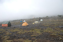
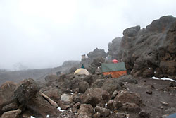
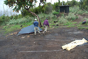 Supper that night (and every night) was sumptuous by camping standards—a huge bowl of soup, followed by a huge plate of pasta (rice on some nights) with chicken curry sauce, vegetables cooked from fresh, fresh tomatoes and cucumbers, and toast, followed by fresh fruits (pineapple, mango, and banana). The sauce for the pasta or rice varied from night to night, including beef stroganoff, a couple of other chicken and beef sauces, and a bean sauce. In the image at left, the small tent is my sleeping tent, while the one to be set up in the foreground was the eating tent.
Breakfast the next morning (and every morning) started with a bowl of hot water to wash up, followed by a huge bowl of porridge, eggs, sausage (if you eat processed meats, which I don’t), fried potatoes, fresh melon (usually two kinds), fresh mango and pineapple, pancakes (these were more like crepes), and toast. Toast and the crepes always came with margarine, peanut butter, jam, marmalade, and honey. I was never able to finish any of the meals, since they were much larger than the amount that Barb and I eat combined at home. I accused Joseph, my cook, of trying to fatten me up, while he was always disappointed that I didn’t finish everything and clean the plate.
I should emphasize, though, that my crew and I got along very well together, with me struggling to learn more Swahili, a couple of the porters working to improve their English, and lots of joking on all sides. As a side note, an effort to learn some Swahili goes a long way to helping the tone of the hike (and the safari). Try very hard to go beyond the basic greeting “jambo,” and learn how to say “thank you” and “you are welcome” at the very minimum.
 On December 21, we packed and headed for Shira Camp, in more rain. The rain turned to sleet along the way. That day, the 5.5 km was covered in 4 hours 49 minutes, with a total gain of 3,180 feet to gain the Shira Camp at 3,841 meters (12,600 ft). This included a leisurely lunch stop and a number of photos, mostly in the fog.
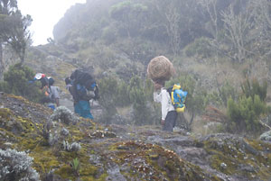
Lunches consisted of two sandwiches, a piece of fried chicken (fish one day), banana, muffin, biscuits (in the U.S. we call these crackers), box of juice, and an orange (cut into sections to suck on). I came close to finishing the lunches each day. The image at left shows the typical load carried by the porters, and the way they carry the loads. Supposedly, the total load, including their personal gear, is 20 kg. But that’s got to be the heaviest 20 kg I have ever seen.
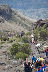
 The image at left shows some of the other hikers, as well as porters. And, yes, the woman in the photo did summit. The literature says that any experienced trekker can do the hike. However, a number of people did turn back, and many took the full 8 hours or more between campsites mentioned in the guidebooks. There are a few places along the way that might call for using a hand for balance, but contrary to some of the guidebooks, I did not observe any places where there was any Class 3 scrambling.
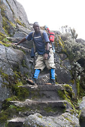
The image at right shows a section between Machame and Shira that is shown in the guidebooks as involving a scramble. Patrick (in the photo) told me this section had been modified with the steps in the past year or two, because a number of people had slipped and broken legs or suffered other injuries.
 On arriving at Shira Camp, during the process of setting up camp, there were loud claps of thunder and some flashes of lightning. Plus, we got sleet, enough to cover the ground white. I will admit to being a bit apprehensive about the lightning, although when the weather cleared that evening, it appeared that there were enough ridges and higher locations to provide a “safe zone” from the lightning at the camp (despite recent articles discussing the fallacies of traditional “safe zones”). No static electricity, though.
 There was time to join some of the other hikers in wandering over to Shira Cave to explore the place where many early explorers camped (camping in the cave is forbidden these days for safety reasons).
The warm temperatures soon melted the sleet from the ground, and we got a beautiful sunset behind Mt. Meru, used by many people for an acclimatization hike before hiking Kili. From their reports, however, Meru is a more challenging hike than Kilimanjaro, with some moderately serious scrambling.
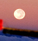
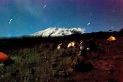 During the night, I shot a moonlit image of Kilimanjaro. The full moon was approaching, with the planned summit day being the night of the full moon, meaning less need for a headlamp. Since the exposure was 30 seconds, and basically handheld, there are a few wiggly star trails. I did rest the camera against the tent pole, but that wasn’t much help.
I suppose I should have had the porters carry my tripod, or used the monopod/hiking pole to brace the camera. But a monopod only provides one direction of bracing. Hey, just consider it an “artistic effort”!
The next day, December 22, was slated to include a loop up to the foot of Lava Tower to add a little bit of “climb high, sleep low” acclimatization. However, when Patrick and I got to the trail junction, it was raining and foggy. So there would be no views (confirmed by talking to others at Barranca camp when they arrived). Besides, I acclimatize well, and Patrick’s judgment was that I was moving fast enough (despite his continuous entreaties of “polepole,” meaning “slowly” in Swahili).
During the whole hike, I had none of the indications of altitude problems—no headaches, no nausea, no shortness of breath. The only problems I suffered were side effects of the antimalaria medicine I was taking, namely increased sun sensitivity (I burned my nose on summit day, despite using plenty of SPF50 sunblock) and a minor change in lower intestine activity that had showed up within the first couple of days and persisted for the remaining four weeks that you have to continue the medicine after leaving the malaria-risk area, both listed in the pharmacist’s data sheet (other side effects did not appear, but I advise carefully reading).
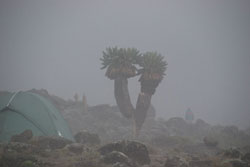 Barranca is a beautiful campsite, filled with several varieties of lobellia, large and small. The fog made for interesting images, though the views of the scenery came and went. During the 9.9 km hike, it rained, sleeted, and snowed, which resulted in taking 5 hours 17 minutes for the total gain of 2,400 feet (and descent of 1,880 ft), ending at 3,993 m (13,100 ft). That is only a net gain for the day of 500 feet, but the next two days would be more of a challenge.
 In the photo at right, you can see the infamous Barranca Wall. A fairly large number of people find the appearance of this wall to be intimidating enough that they turn back here, descending by a trail that heads pretty much straight down the valley. In actuality, there is no significant exposure, and the trail is quite good. There are a few large steps up, but hiking poles or the occasional hand to balance is more than sufficient.
 On December 23, we headed for the high camp at Barafu (which means snow or frost in Swahili). On the way, we descended into Karanga Valley, where the last water is to be found, then up past Karanga Camp, where those on a seven-day schedule camp for a night before ascending to Barafu Camp. The 9.0 km took us 5 hours 56 minutes, including a long lunch and still more photos (the weather cleared somewhat), with an altitude gain of 3,478 feet, ending at 4,652 m (15,260 ft).
The tent sites were nestled among the boulders. As usual, I had to sign into the register, pulling out my passport to copy the number (getting hard to do with my fogged up glasses). Many of the latrines were newly built, with signs designating which were for the porters and which were for the “tourists.” These are a vast improvement over the old latrines. However, they still have a small rectangular hole in the floor over which you squat (practice your aim!).
Dinner was a little earlier than usual, to allow getting as much sleep as possible. At 11 p.m., I awoke and prepared for the ascent. The weather was perfect, with the full moon providing plenty of light. At 11:40 p.m., Fostine brought a small breakfast, then I gathered my gear, including three and a half liters of water (1.5 in my Camelbak, with Bill Gookin’s Hydrolyte mixed in), and made sure I had a fresh spare battery for the camera, spare batteries for the GPSR, several small candy bars, a bottle of 5 Hour Energy Drink, and both headlamps. At 12:16 a.m. (now December 24), Patrick and I set out for the summit. It didn’t take long to decide to turn off the headlamp, since the full moon was providing more than enough illumination.
We kept a steady “polepole” pace for a couple hours, until I was feeling cold and draining my energy too fast. So we stopped to put on another layer, whereupon I discovered that the 5 Hour Energy Drink was frozen and the candy bars were like bricks. Luckily, the packets of Gu were still fluid enough to suck down. Since I learned the secret of keeping the Camelbak liquid (wear it under your jacket and run the hose down your sleeve), I was staying well hydrated.
I noticed the GPSR was indicating very low battery, so I started searching for the replacements. They had disappeared! Rats! So I turned the unit off and have no further track until I returned to camp and discovered they were in my parka pocket under the camera spare battery. And much later, I realized that my larger headlamp also used AA batteries that I could have used. Oh, well. I have most of the track, anyway.
We continued upward at a steady pace, with no further stops. At one point, Patrick asked me how long I estimated until Stella Point, the crater rim where many people (and the first ascent party) turned back. I guessed an hour. Patrick said it was a half hour. Five minutes later, we emerged onto the crater rim at Stella Point.  If you turn back here, you receive a “Silver” certificate. We pushed on at an increased pace, and in 20 minutes stood at the summit sign on Uhuru Peak.
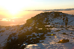
 We had passed two parties descending shortly after passing Stella Point. Both of these had taken their summit photos by flash in the dark. Patrick had timed our ascent pace to arrive at the summit exactly at sunrise (and the setting of the full moon). The image at right shows the setting moon behind the summit sign.
Patrick and I had the summit to ourselves during the 12 to 15 minutes we were there taking photos and enjoying the views. Since I occasionally visit geocaches, I gave brief thought to trying to find the second cache at the summit (the sign, properly interpreted, provides the information for the virtual for the summit itself).
But we were seeing other parties ascending, and soon our solitude would be broken, as can be seen in the sunrise image. So we started down.
Among the images I obtained are these two of the “Snows of Kilimanjaro.” The first is of the Southern Icefields and is the Kersten Glacier. The second is toward the north, showing the crater and the Northern Icefield.
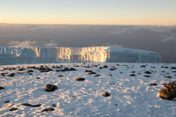
 There has been much talk about the melting of the glaciers. Strictly speaking, this is not correct. The ice is subliming directly into the atmosphere. It does not pass through a liquid phase and is not contributing to the springs and streams found around the mountain, which are the sources of water for the villages and towns (and the extensive coffee and banana plantations).
As shown by recent studies, the main source of heat to drive the water vapor off is the heat from the magma inside the mountain, which was responsible for the eruptions of the volcano over 250,000 years ago. There is one currently active volcano nearby, at the edge of Ngorongoro Crater.
We passed more parties on their way up, including a man and his guide below Stella Point that we had passed on our way up (I found out later that he turned back at Stella Point). We also passed a large party well below Stella Point, with at least another hour to go. They did summit.
As we approached the camp, we were greeted by Nuru, the youngest of my porters. He took our gear except for my Camelbak (still liquid, and having been replenished while on the summit from one of my Nalgenes) and camera. A few minutes later, I was back at my tent, being congratulated and roundly hugged by all my porters, who were exclaiming on how strong “Babu” was (Babu is Swahili for “grandfather” literally, and is used as a term of respect for someone old enough to be a grandfather). Most of the time they called me “Papa,” and when we were eventually down to the Mweka Gate, where we exited, they told me they considered me like their fathers.
Total time to the summit and return to Barafu was 8 hours 14 minutes for an estimated distance of 10 km, a total ascent of 5,774 feet and descent of 5,810 feet (the difference being due to the normal fluctuations of the atmosphere during the day). In principle, the summit is 1,243 m (4,078 feet) higher than Barafu. However, as for most of the camps, I found the GPS-derived altitude of the camp to be somewhat lower than the guidebook value, plus we were not camped at the highest part of the camp.
After some refreshments, I lay down for about an hour’s rest. Then I packed my gear and Patrick and I headed down to Mweka Camp, about 12 km and 4,700 feet lower. We took our time to enjoy sights, reminisce on the climb, and discuss many things. Going downhill is harder on the legs, so we stopped a few times to shake and rub out the lactic acid that accumulates during exercise.
Our time down was 3 hours and 4 minutes. Still, as leisurely as we were, we passed a large number of other parties (and were passed by many porters). My porters caught up with us about halfway and stayed with us for a few kilometers before stepping back up to their usual pace, so that my tent would be ready when I got there, as usual. And of course, the tea and popcorn were waiting when I arrived.
After a good night's sleep, I got up on Christmas Day to receive the usual sumptuous breakfast, packed, and Patrick and I headed down. Before long, porters started catching up and passing, virtually all calling out congratulations to “Babu,” along with comments on how strong I was. It seemed I had become famous (I was heading down almost as fast as many of the porters; but then downhill is always faster, since gravity is helping you). Since most of the guides and porters are Christian (Catholic for the majority), there was much singing of Christmas carols and Christmas-related songs all the way down the trail (including such favorites as "Rudolph the Red-Nosed Reindeer" and "White Christmas"!).
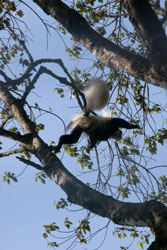 Still, we stopped many times to watch and photograph the flowers, rain forest, and the beautiful black and white colobus monkeys. These monkeys have very long white tails that somehow do not seem to get tangled in the branches. However, they are heavy enough that in leaping from branch to branch, I often heard branches breaking under their weight.
As we approached the gate, Patrick asked me how far I thought it was. My guess, as it had been approaching Stella Point, was another hour of so. Sure enough, yet again, five minutes later, as we rounded a bend in the trail, there was the gate.
As I walked into the gate area, I was besieged by a horde of vendors hawking T-shirts (“I climbed Kilimanjaro,” no questions asked about whether you summited), Maasai spears and knives, paintings, and various carved masks and animal figures. The important Swahili word to know is “hapana!” said forcefully (meaning “NO!").
I put my pack and other gear into the EcoTours van and walked over with Patrick to the office to sign out (followed by more vendors). Again, get the passport out to read the number. This time there were two books to sign out. Then I gathered my crew together to thank them and to hand out some tips for a job well done. These tips are tiny enough by U.S. or European standards, but the guide services, guidebooks, and other sources caution you to not hand out rewards that are out of line with local income standards, no matter how excellent the job. Still, I added some small bonuses, and back at the hotel I had brought some warm jackets and sweaters and a pair of boots that were still good, though the soles were a bit worn (look at the clothes and footwear on the porters in the photo).
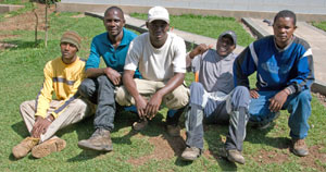 From the left, my crew was Nuru (youngest of the porters), Chacha (really tall guy who packed my tent and set it up every day), Patrick (my most excellent guide), Fostine (porter, waiter, aspirant guide, with a fantastic sense of humor), and Joseph (my cook, who worked hard at fattening me up with his excellent food). As we said farewell and I got into the van, the crew surprised me by all saying that they had learned a lot from me, then each gave me a big hug.
Patrick and I got in the van, along with the other party of four from EcoTours and their guide. Still the vendors tried to get us to buy the various souvenirs. Special deals on T-shirts! Special Christmas price. I suggested that since it was Christmas, they should give me one as a Christmas present. No such deal.
That evening, back at the hotel, after washing up, Patrick and I had a very pleasant traditional Christmas dinner—turkey with all the trimmings. Then the next morning, I packed everything, talked with others who had gotten back from the mountain (including a fair number of “walking wounded”), and generally passed time until my ride to the airport at 6 p.m. Then 27 hours later, I was back in Palo Alto, trying to shift my personal “Local Body Time” by 11 time zones.
The Safari
 Shifting gears, I return to the safari that Barb and I did at the start of the trip. This mostly consists of photos. As stated earlier, we shot some 2,600 images on the three cameras. The camera gear list is far too extensive to list here, so suffice it to say, we were well equipped and lacked for nothing significant. The flight from San Francisco included a change of planes in Minneapolis and another in Amsterdam.
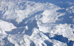
The total time to Tanzania's Kilimanjaro International Airport (JRO) was about 27 hours, plus the necessary early arrival at the airport for security procedures. The leg from Amsterdam was during midday, which gave us a great view of the Alps. The Matterhorn is in the middle of the image at left, though it looks quite different from the perspective of 32,000 feet.
 We had a rest day at the Keys Hotel (our headquarters for the trip), during which we sorted gear, walked downtown through Moshi (and were besieged by vendors offering everything from Maasai knives and spears to carvings and offers to arrange tours of the town and local villages by taxi, to offers to arrange safaris and hikes up the hills). As you might expect from a latitude of 3 degrees south of the Equator, the temperature and humidity were very high, despite the altitude of a couple thousand feet.
A couple things to note—since this is equatorial Africa, it is not only hot, but there are mosquitoes and other insects and critters that carry a wide variety of diseases. It is advisable for all the diseases (and mandatory for some), that you get vaccinated or immunized, or follow a program of prophylaxis. Thus a few months before the trip, we visited our travel medicine clinic and became pincushions, and during the trip took an antimalarial pill daily. The beds in the hotels all have mosquito netting, which you should make a point of using.
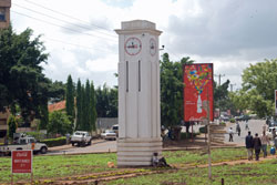 During our walk, we looked at the local mosque (a large one, which had awakened us with the dawn call to prayers) and a Sikh temple. Since it was about lunchtime, we sought out the IndoItalian Restaurant, which is recommended by several guidebooks. While Barbara enjoyed tandoori chicken, I had a Tanzanian-style chicken dish, the name of which I have forgotten. The photo at left shows the Clock Tower, a major landmark in the middle of a traffic circle on the walk into Moshi from the hotel (distances are small enough that walking is the most reasonable way to get around, even in the heat).
Back at the hotel, we met with Phillip, the director of EcoTours, and with our guide for the safari, Halfan. We discussed the arrangements and our goals for the trek.
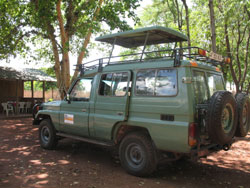 The next morning, Halfan and our cook, Shakespeare, arrived in his Land Cruiser to load our gear and head for Manyara National Park (Toyota seems to dominate the car market, though the models differ in many ways from similarly named models in the U.S.). We drove for several hours before arriving at Twiga Campground (Twiga is the Swahili name for giraffe), just outside the park.
We dropped Shakespeare and the gear off to set up camp and eat lunch, which was the same as I was to have on the mountain. In fact, all the meals were of the same type as on the mountain, with plenty of fresh fruits and vegetables, as well as pasta and a large variety of dishes. Then we headed with Hamfan for the park.
As a side note, notice the pop-up top on the Land Cruiser. When you go on safari, be sure your vehicle has a shaded pop-up top, as ours did. We saw people in vehicles with sliding roofs, who were suffering in the brilliant sunlight and heat, and people in vehicles with solid roofs who could hardly see anything at all. The visual access provided by the roof adds immensely to the experience and allows for much better photography.
From the moment we entered the park, we saw myriads of animals we had only seen in zoos. Since we saw many of these same animals and birds in each of the parks, I will put the photos together with captions. However, there is no room to show all 100-plus animals (including mammals, birds, reptiles, and insects) we have identified in our photographs, not to mention the dozens I have yet to identify. I am not a confirmed birder, but I would guess that if we could identify all the birds we saw, I would have easily doubled my Life List.
We spent many hours in observing and photographing the animals, then, just at sunset, left the park to return to the campground. Truth to be told, we actually were a bit late exiting the gate, but our excuse was that as we got close to the gate, a leopard ran across the road just ahead of us. Leopards are shy enough that we spent about 15 minutes trying to get a clear view to photograph it.
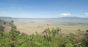
View of Ngorongoro Crater from the rim
The next morning, December 15, we drove up the face of the Great Rift (Lake Manyara is a sink pond at the bottom of the scarp), stopping for an excellent view. Then we headed across the savannah and up the side of Ngorongoro Crater and through the entrance gate, on up to the rim of the crater. After pausing to shoot some photos (the one here with a 12mm wide angle lens), we headed on to the Oldupai Gorge museum.
No, that is not a typo. The correct spelling of the Maasai name for the sisal plant, after which the gorge is named, has a “p,” not the “v” usually seen in U.S. and European publications. It seems that the Dutch butterfly chaser who discovered the gorge and the first bones misunderstood the Maasai who told him the name of the place. At the museum, we got a personal discussion of the history of the dig from a young Maasai who has been working at the dig, and is now studying to become an anthropologist himself. He plans to return to the area to do his research.
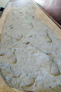 At the museum, we saw a casting made of the famous footprints (image at left). The footprints themselves have been recovered to protect them from deterioration and allow study by future generations of scientists. It is possible to visit some of the digs in progress, though generally only for qualified persons (we were told that we can qualify because of my background and a couple of research articles of mine, so we may return here someday).
Then we headed on to Serengeti National Park and to our campground for two days. Along the way, we viewed thousands of wildebeest, zebras, and various antelope, along with hyenas and jackals. At the turn toward our campground, we stopped for a while to photograph a pair of cheetahs. Then on to the campground to drop off Shakespeare and the gear, and off to a few hours of hunting the beasts.
Over the next day and a half, we spotted and photographed many critters and observed many activities, including hunts by them, both successful and (mostly) unsuccessful. We, on the other hand, were well fed, eating off a table covered with a tablecloth with metal tableware.
We had no rain during the safari, unlike during my hike up Kilimanjaro. But then, the Serengeti gets little rain, even during the “rainy” season. This is why the herds of vegetarians (antelope, zebras, wildebeest, etc) and their predators are engaged in a continual migration. As our extremely knowledgeable guide, Halfan, told us, the animals follow the rain, not some artificial schedule as printed on many of the maps for tourists.
This may mean that they go clockwise or counterclockwise, or even cut directly across the plains. They sense where the rains are, and head for those areas, where the grasses will be greener. The groupings of animals are complementary. Certain ones (zebras) are more aware of the presence of predators, like lion, than are others (wildebeest), and their eating habits are complementary as well (certain ones eat taller grasses, while others crop the shorter grasses, while giraffes eat from trees, and so stick to more wooded areas).
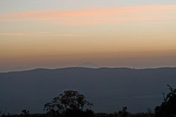
 Time came that we needed to leave the Serengeti and head for Ngorongoro Crater. The image at left shows sunset at our campsite on our last night in the Serengeti. We left midafternoon to exit the gate at the appointed hour (entrance and departure times are specified in the guides’ permits), pausing several times along the way to photograph still more animals.
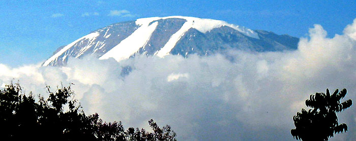
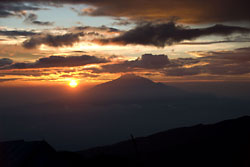
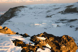
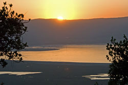
 At the Crater’s Simba Camp, we set up camp and enjoyed yet another fine dinner. We headed to bed early so that we could get up before dawn to get an early start in the crater bottom, when the animals would be most active. The image at right was at sunrise from the crater rim and our campsite. The triangular mountaintop beyond the rim is Mt. Meru, and the flatter one that appears lower to the left is Kilimanjaro.
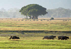
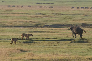
 Just about at sunrise, we headed for the crater. The road down the wall of the crater was steep enough to require full 4WD with all differentials locked. As soon as we got to the floor, we saw literally thousands of birds and hundreds of large mammals. The lake visible in the photo at left appeared to have a pink shoreline. This turned out to be due to thousands of flamingos. We soon witnessed three lions attempting to bring down a large male buffalo. Dumb young lions! That’s like a motorcycle trying to bring down an 18-wheeler (a photo is included later).
The day was exciting, with lots of images collected of dozens of different animals. Finally, we had to drive back to the campground, have a late lunch, and load everything into the Land Cruiser, along with Shakespeare. The long drive back to Moshi was broken with a stop at a major trading post for crafts by local artists (and one of the major sources of tanzanite jewelry, custom made on the spot). Although the carvings, paintings, and jewelry were of excellent quality (we were told that Bill and Hillary Clinton were customers), we resisted any purchases. As might be expected for the high quality, the prices were also high, and there was the question of getting the more delicate carvings back home without damage.
And so back to the Keys Hotel, with an evening dinner with our guide and cook to review the safari. The next day was spent in repacking for my hike up the hill and Barb’s departure.
Photos from the Safari
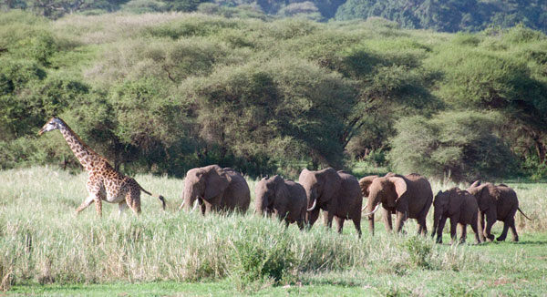
Giraffe in Manyara, leading a group of elephants
|
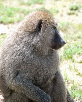
Olive baboon |
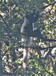
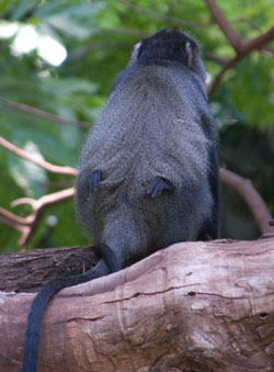
Blue monkey, with young |
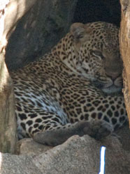
Leopard in Serengeti (Chui)
|
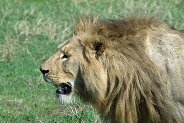
Lion in Ngorongoro Crater (Simba) |
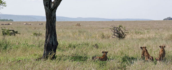
Lions contemplating zebras for lunch (unsuccessful hunt)
|
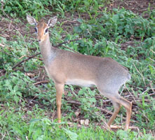
Dik Dik, smallest of the antelopes |
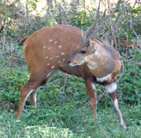
Bushbuck |
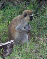
Blackfaced Vervet monkey |
|
Lion attempting to bring down water buffalo |
Water buffalo facing off two lions, after throwing one off |
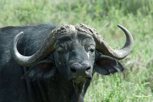 A handsome water buffalo male (Nyati) |
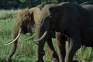
Two elephants (Ndovu) |
|
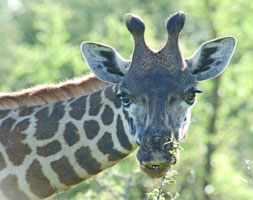
Maasai giraffe (Twiga) |
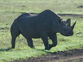
Black rhinoceros (Kifaru)—note damaged front horn |
|
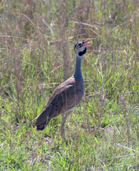
White-bellied bustard |
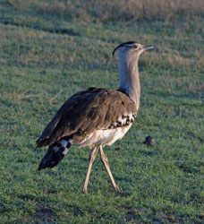
Kori bustard, Africa’s heaviest flying bird |
|
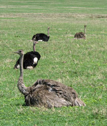
Ostriches in Ngorongoro |
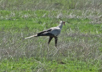
Secretary bird—note the “quill pens” behind the head |
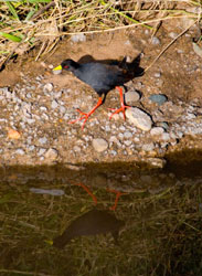
African black crake—note crake’s reflection in water |
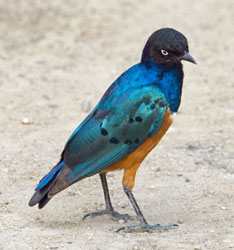
Superb starling |
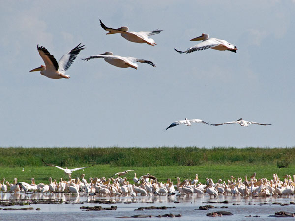
Pelicans flying over Lake Manyara, hippopotami and various other bird species
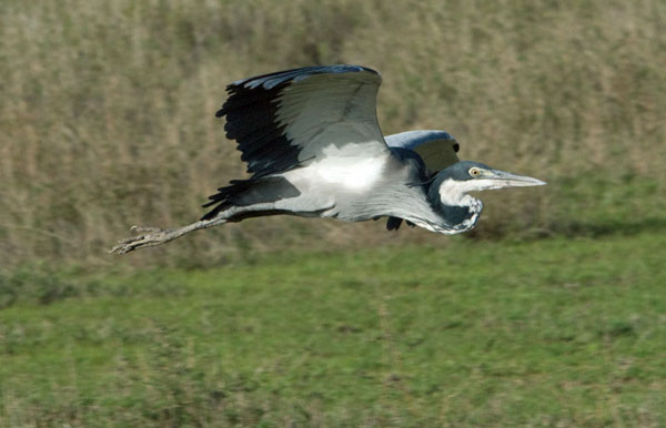
Black-headed heron
|
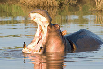
Hippo yawning in Serengeti |
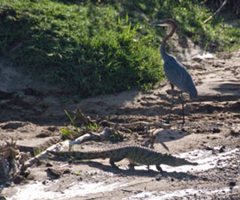
Nile crocodile and black-headed heron |
|
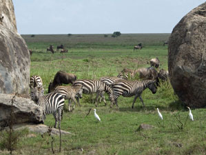
Zebras and wildebeest |
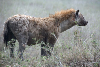
Spotted hyena |
|
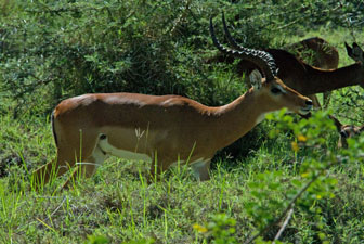
Impala |
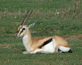
Thompson's gazelle |
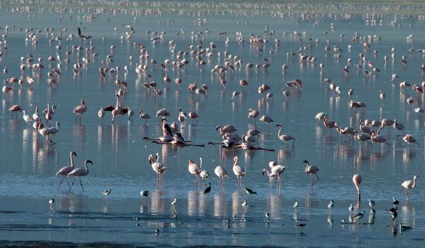
Flamingos in Ngorongoro Crater
|
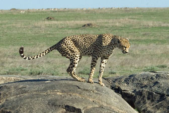
Cheetah |
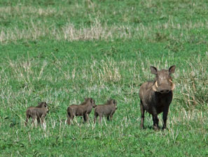
Warthog with young |
|
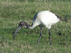
Sacred ibis |
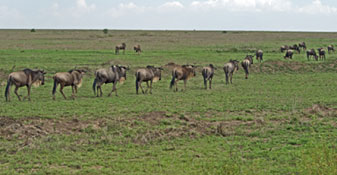 Wildebeest on migration Wildebeest on migration |
|
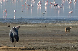
Maribou stork and common jackal |
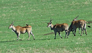
Eland, largest of the antelopes |
|
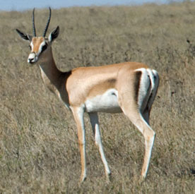
Grant's gazelle |
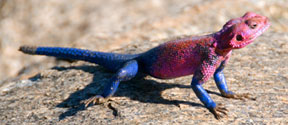
Agama lizard
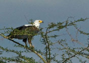
African fish eagle |
|
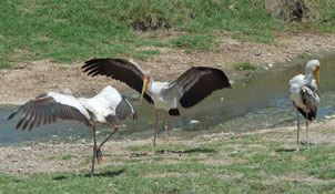
Yellow-billed storks |
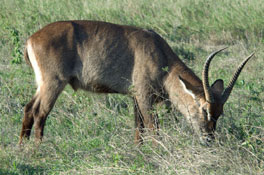
Male waterbuck |

The photographers, Barb and Bill, at the edge of a northern Serengeti hippo pool.
Note crocodile summing itself on the left background rocks (see below for a closer view)
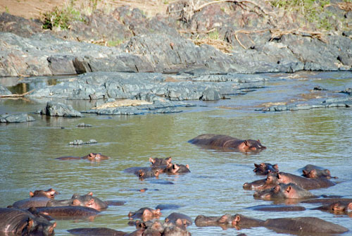
Serengeti hippo pool—note Nile crocodile on rocks on rocks.


