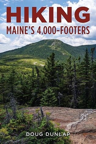
Down East Books Hiking Maine's 4,000-Footers


 Reviewed by
LoneStranger
TOP 10 REVIEWER
REVIEW CORPS
+14,829
 September 14, 2021
Hiking Maine's 4000 Footers is a guide book with detailed descriptions for day hiking each of Maine's 14 high peaks. Doug Dunlap has authored several other books on Maine hiking and includes a lot of basic hiking info for newer hikers in this guide.
Pros
- Accurate trail descriptions
- Lots of basic info for newer hikers
- Small reference maps
Cons
- Some repetitive text
- No elevation profiles
Doug Dunlap has written several books on hiking and snowshoeing in Western Maine. Doug is a Registered Maine Guide and he's been hiking for over 40 years in New England, hitting all 67 4k summits. In Hiking Maine's 4,000 Footers he takes on the 14 high peaks in the state. He follows the spine of Maine's mountains from Old Speck northward over Saddleback, Abraham, Spaulding, Sugarloaf, Reddington, the Crockers, the Bigelows & finally the three high peaks of Baxter State Park, N Brother, Hamlin and Baxter Peak on Katahdin. Each hike includes a small map of the area which doesn't provide a lot of detail, but is useful as a reference while reading through the description of the trail or trails involved.
Background Info:
Before he gets into the detailed information about each of the fourteen hikes Dunlap spends about 25 pages going over an introduction to hiking in Maine and a lot of basic hike planning and safety. Knowing the mountains of Maine as I do I thought that was a really good idea for folks who are not as familiar.
In this opening section the author gives brief, but useful advice on what to wear, what to pack including the idea of the 10 Essentials which Dunlap suggests as a starting point to making a list of your own essentials. He also covers dog and child considerations, group hiking and the importance of having a turn around time before hitting on navigation and map use before moving on to the individual hikes.
The Hikes:
Each hike has a quick info section that gives a lot of info at a glace. Here is an example:
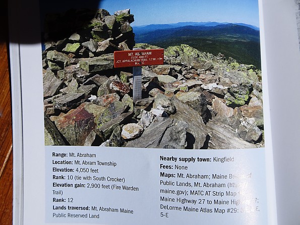
This is a nice feature for folks trying to decide on a hike. You can easily get an idea of difficulty and how the hike compares with the others on the list.
The first hike on the list is one I am very familiar with, Old Speck. While I've climbed it from all three directions, Dunlap's book is focused on day hiking so only covered the direct approach from the highway, but does make mention of Speck Pond on the AT farther south. He mentions that he has climbed this mountain many times and you can tell from his description that he likes it. While I may have mentioned the potentially soul crushing false summits on the way up, he describes them as a series of knolls which is warning enough I suppose. In reading this section I noted that Dunlap's descriptions of the route and trail conditions are pretty accurate based on my memories. While he makes mention of scrambles and steep pitches near the top I'm not sure he does a good enough job of conveying how ugly the ugly parts of this climb can be, especially when wet, but I think he is trying to avoid being discouraging.
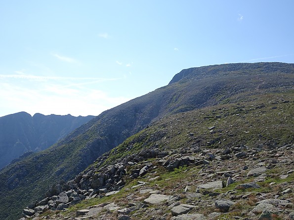
The next section is devoted to the Saddleback Range which includes Saddleback and The Horn as far as high peaks. Having never hiked in this area before it made for a great opportunity to look at Hiking Maine's 4,000 Footers from a different, inexperienced perspective.
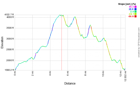
Reading Dunlap's description of the Saddleback ascent via the AT made the climb seem straight forward enough. Thankfully I looked at the elevation profile before heading out because again I think he glossed over just how steep the last mile or so to the summit really is. Perhaps it would be helpful to include profiles along with the small maps in the book.
We'll skip ahead to the Greatest Mountain so I don't spoil the whole book. While I haven't summited Katahdin from all possible directions, the author, Doug Dunlap, has and he goes into great detail on each of the ascent routes. His descriptions of the trails again doesn't go on at length about the difficulty, but he does acknowledge that there is no easy way up this mountain which I appreciated.
Additional Info:
After wrapping up the detail trail descriptions for each of the summits Dunlap included another section with some information beyond standard day hiking. He starts by briefly mentioning a few 4,000 foot peaks that didn't make the list; Pamola/Knife Edge & the Howe Peaks. These summits lack prominence to qualify for the lists, but are certainly worth visiting.
The next section made me happy to see because it discussed some overnight options for backpacking trips hitting the high peaks. Dunlap included established campsite options for each hike along with route suggestions. Along with that he included some very brief tips for overnight camping included info on water, shared lean to etiquette, food protection and Leave No Trace principles.
There also was an extended discussion of accessing Maine's high peaks in Winter. Dunlap devotes over six pages to cover the basics such as weather conditions, trail access, navigation and route finding. Along with the general info he also includes a section with detailed winter information for each peak.
There also is a brief section dedicated to fishing while hiking the high peaks which lists possible locations near or on the routes.
Finally there is an appendix that includes a check list of summits with space for marking dates and making notes, another with info on the 4k Club, one with info on trail maintainers, another on trail towns and resupply points and an extended list of hiker terminology plus a list of other books the author recommends.
Conclusions:
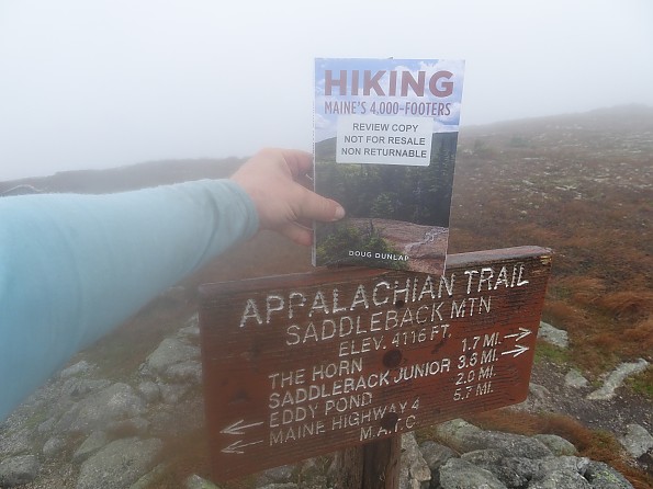
First let me say that this book isn't really intended to go out on trail with you. I carried it to take a pic for this review, but it weighs over 14oz and the pointy corners were in my back one day. Read at home and take notes if you want, but you will be happier leaving it behind when you're headed up the high peaks.
Over all I think Doug Dunlap has put together a pretty good guide on hitting the high peaks of Maine. The trail descriptions are a bit more optimistic than I might use, but I've only been a Mainiac for a bit over a decade so am still getting used to just how rugged the trails here can be. As noted earlier, his goal is to inspire, not instill fear, so I understand why his descriptions might not be as dramatic as mine heh.
The opening section with info on clothing, pack loads, water and general safety was really well done. Short and to the point, but full of good advice that might be second nature for old hands, but valuable insight for new hikers.
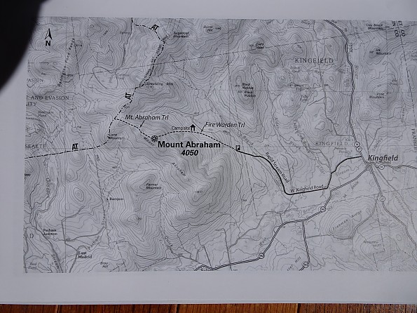
I think anyone aspiring to summit the 14 high peaks of Maine could benefit from Dunlap's guide. From new hikers to experienced trail folks there is info you can use to plan a successful hike. Additional maps are definitely in order though as Hiking Maine's 4,000 Footers includes only rough maps of each summit area with various routes noted. Planning and preparing for the hikes is what this guide is all about. It has great value as a reference, especially for folks hitting a particular summit for the first time.
Background
I have very limited experience with hiking guide books but have enjoyed reading and rereading this one several times over this Summer.
Source: received for testing via the Trailspace Review Corps
(Sample for testing and review provided by Down East Books)
Your Review
Where to Buy
You May Like
Specs
| Price |
Historic Range: $16.39-$18.95 |
| Author |
Doug Dunlap |
| Pages |
208 |