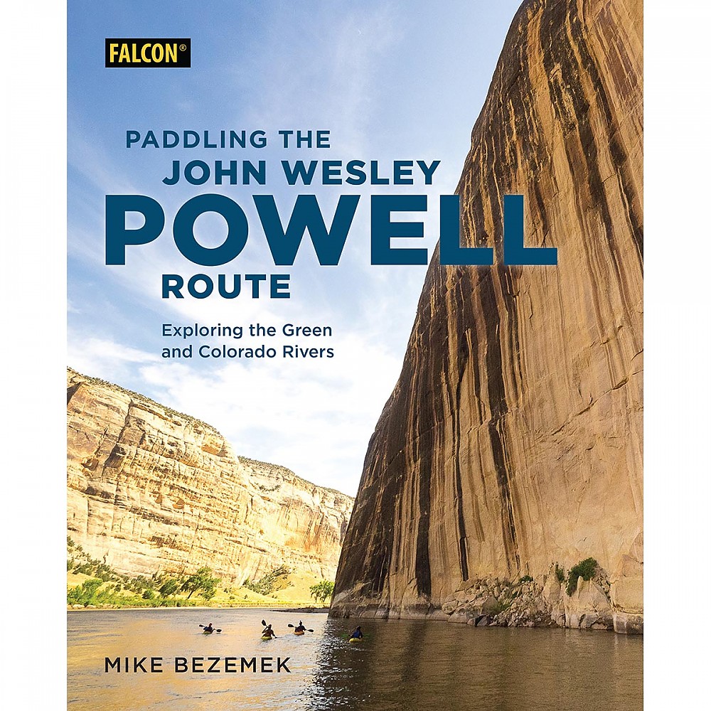
Falcon Guides Paddling the John Wesley Powell Route: Exploring the Green and Colorado Rivers


 Reviewed by
BigRed
TOP 10 REVIEWER
REVIEW CORPS
+10,775
 March 28, 2019
"Paddling the John Wesley Powell Route" is a meta-guidebook to 1,700 miles of river and reservoir in the footsteps (well, oarstrokes) of Powell, who led the first expedition down the Green and Colorado rivers through the Grand Canyon. It's a valuable planning resource for everything from day trips to the whole exhausting journey, but too general for day-to-day details.
Pros
- An excellent planning resource, with info on access, permits, suppliers and outfitters, and side trips
- General info on regional geology, flora and fauna, and history
- Photos and sidebars provide inspiration and food for thought
Cons
- Minor errors on the natural history, and this reader could always use a little more on that front
- Not the one book you'll need to have in your boat
- Maps could offer a few more details
Aficionados of the desert Southwest know the scene: 1869. John Wesley Powell, a one-armed Civil War veteran, seated in a wooden armchair strapped to the deck of a wooden boat, sets off from the railroad town of Green River Station, Wyoming, with a hardy crew of nine other men, aiming to fill in the last blank space on the U.S. map, on rivers about which little is known except for that they drop over a mile across the unknown region.
Rumor has it that the whole river just disappears into a great big hole somewhere in there, only to emerge again in the depths of the Grand Canyon. Nearly 100 days later, six bedraggled survivors reappear at the confluence of the Colorado and Virgin rivers in southern Utah, having survived diminishing rations and monster rapids that still flip big rubber rafts to this day.
That classic story is the inspiration for this inspiring guidebook. In broad strokes it provides the information needed for modern two-armed adventurers with paddles and oars to plan, if not fully execute, trips along the Powell route. It includes ideas for day excursions on some river segments and reservoirs, multiday routes on the major segments, and some discussion of what you’d need, time-, gear-, and attitude-wise, to do the whole enchilada.
As a bonus, the book also covers the upper stretch of the Green River from near its headwaters in the Wind River Mountains to Green River, Wyoming, where Powell began his journey, and the compromised lower stretch of the Colorado River from Lake Meade to its extinction in or near (depending on the vagaries of water politics and climate) the head of the Sea of Cortez in Mexico.
Although I wouldn’t call myself a river rat, I have had the great pleasure of intersecting or even floating a few portions of this 1,700-mile long route at various times in my life, and I currently harbor the ambition to do at least one more trip, on the 168-mile quiet stretch of the Green through Canyonlands National Park to its confluence with the Colorado. When it comes to big whitewater, I myself have a lot more enthusiasm than experience, but there is enough swiftwater, low level rapids, and scenic reservoir paddling along the route to make this book useful to paddlers of all stripes.
The author, Mike Bezemek, is a river rat, comfortable in the full range of water and watercraft styles from quiet water canoeing to class V kayaking. He writes two regular columns for Canoe & Kayak magazine, authored Falcon’s guide to Paddling the Ozarks, freelances to other outdoor related publications, and fills out the rest of his writing hours with a well-received blog. Bezemek has section-paddled the entire route, and the book’s enthusiastic foreword is contributed by another C&K contributor, Zak Podmore, who has done the whole thing in one go, twice. The final chapter includes highlights from an interview with Podmore’s partner, Will Stauffer-Norris.
While most of the book is businesslike, as a guidebook should be, Bezemek spices it up with sidebars, quotes from Powell and others on his team, contributions from other river veterans, a serial recapitulation of the Powell adventure, and his own witty asides. Example: “If you ever meet paddlers attempting this 1,700 mile odyssey, buy them a beer and some clean underwear – they probably need it.”
Oh, and there are plenty of photos, historical and modern, including many of Bezemek's own, to help whet your appetite for desert scenery, big water, and some of the little details that make a trip special. His photos are copyrighted, so here's one of my own for some flavor: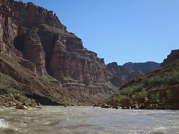
The book begins with a preview of the Powell story and the author’s reminiscence of his own engagement with the river. From there we get a rundown on what to expect on a river trip, including a fast-track treatment of regional geology, weather, flora and fauna (as a botanist, I take umbrage at his referring to yuccas as cactuses – not!). There is two-page spread on Leave No Trace, river style—yes, you should pee in the river and carry all other waste out. Here I can’t help but smile quietly when I point out another biological inaccuracy, a mention of fragile macrobiotic soils, where the correct term would be cryptobiotic.
The introduction also foreshadows one of the more important themes in the following chapters, the diverse permit systems that regulate the flow of boats and people on many sections. It winds down with a discussion of boat and other equipment choices and requirements, and a list of other books and resources that can be used to fill in the details on each section of the journey and the blank spots in your mind about the Powell expedition and the history of the river. A personal favorite book of mine, The Emerald Mile, gets a mention, and Bezemek inspired me to watch Ten Who Dared, the deeply flawed but nevertheless retro-entertaining 1960 Disney retelling of the Powell legend.
The rest of the book is really a meta-guidebook. It is not the one book you will want to have on your journey, whether it is one of the recommended day trips or a longer through-paddle. For one thing, it’s not waterproof, as are the handy Belknap river guides you likely will want to have on board. It divides the overall route into 11 sections with a chapter for each that offers an overview of trip options, boat choices, water conditions, the all-important access points, permit info, background reading, and outfitters and local suppliers that can help with everything from supplies and car and boat shuttles to pampered trips through the Grand or Cataract canyons or other thrilling stretches.
Each section offers its own temptations: the uncrowded fishing grounds and wildlife refuges on the upper stretches of the Green, the thrills and spills and grand scenery of the deep canyons with Class IV and V rapids, and low-risk scenery on quiet- and quickwater stretches and reservoirs—the last, hot 400 miles are maybe not so tempting.
 In keeping with the meta-guidebook approach, the overview maps of each section are mostly at scales in the 1:250,000 to 1:600,000 range (exception, that long last bit at 1:3 million) and show the path of the river and main tributaries, lakes and reservoirs, national lands boundaries, main roads, and access points with river miles beginning at Green River, Wyoming, but no attempt to show topography. Except for a token scale bar on each map, all distances are given in miles (quick, Per Erik, what’s 21.6 x 1.6?). For more detail, you’ll want to have the Belknap river guides or other maps recommended for each section.
A terse list of highlights for each section points out some of the more memorable rapids, geologic features, remains of Native American and more recent occupation, and side hikes. Most sections are divided into subsections for recommended variations, usually between access points, with mileage and a few more tips and details for each. The locations of only a very few of the side trips or other waypoints mentioned in the text are shown on the maps.
Abundant photos, topical sidebars, and a 4 to 5 page recap of the relevant Powell experience round out the content for each chapter. These are all very much worth a read and provoke not only the desire to get out there but some deep thought about the current state of the river, drowned as it is under lakes Powell and Meade and dehydrated below the latter (see also: Cadillac Desert).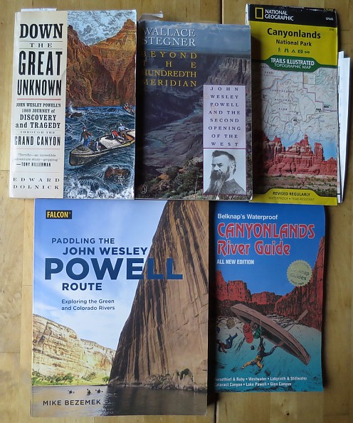
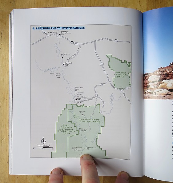
As an example, the chapter on my intended trip, through Labyrinth and Stillwater Canyons, where the Green flows south through BLM land and into Canyonlands National Park to its confluence with the Colorado, describes the section as "offering perhaps some of the finest flatwater paddling through the desert southwest". Perfect for a whitewater-shy couple of duffers like me and my wife, and at least the first 23-mile subsection might work for beginners paddler-campers, who will also find recommendations for day and weekend trips on flat- and easy whitewater sprinkled throughout the book.
Skimming the chapter, I learn that the full segment is 120 miles for 6-10 days worth of paddling but can be shortened or split up into three sections using two intermediate access points. I see that if we are not going to continue on to challenge the whitewater in the next section, Cataract Canyon (which my wife and I have done on a commercial raft trip), we will need to arrange a jet boat ride upstream on the Colorado to get back to Moab; a sidebar lists outfitters, with websites and phone numbers, that offer this service as well as shuttles to and from access points, guided trips, and canoe rentals.
The recommended season is early spring to late fall, but hot in summer. The water level and character is "Class I with a bit of I+ if you're lucky", with gradient of two feet per mile—boring for whitewater thrill seekers, a pleasant downstream float for duffers. The main challenge is finding or carrying drinking water, because the river itself is so silty.
Suitable boats:"You can get anything down this stretch if you have enough time and patience. Long kayaks, SUPs, rafts, canoes, inflatable lounge chairs." And more on campsites, where to get supplies, highlights ("Hey Joe Canyon, on river-left about 21 miles below Ruby Ranch, has a short hike to an abandoned uranium mine" -- wouldn't want to miss that!), regulations, agencies and fees, and more details on the three subsections.
A two-page sidebar highlights the Sesquicentennial Colorado River Exploring Expedition (SCREE) with a mini-interview with its leader, Tom McKinley from the University of Wyoming. A final bit recounts Powell's experience on this section, with three historical photographs and this cryptic observation: "After a second day of mostly portaging... the men made oars while the hungry cook, Hawkins, used the instruments to determine coordinates for the nearest pie."
In size, scope, and design, Paddling the John Wesley Powell Route is about halfway between a coffee table book (or maybe toilet reading) and a take-it-with-you guidebook. If and when I start planning a trip through Labyrinth and Stillwater canyons, this book will provide a solid foundation. The tips on access, permits, outfitters, and side trips will be especially valuable, and would be hard to find all in one place elsewhere.
But when it comes time to depart, I will likely leave this book at home. I already have the much more detailed Belknap river guide and National Geographic map of Canyonlands to take along, and if I want the spirit of Powell in my boat, it will likely be in his own words or those of Wallace Stegner or Edward Dolnick. But it's worth noting that it is also available as an e-book; I suspect the maps and photos would be more or less useless in that format, but the text info could then ride along easy on a cell phone or tablet.
The opportunity to review this book has given me a serendipitous push toward making my river dream a reality—thanks, Falcon and Trailspace!
Background
Raft trips through Cataract Canyon and the "Diamond down" (last two or three days) of the Grand Canyon, hikes in the Green River headwaters, Canyonlands, and Grand Canyon. And I have a bookshelf full of hiking and canoeing guidebooks to compare to.
Source: received for testing via the Trailspace Review Corps
(Sample for review provided by Falcon Guides)
Your Review
Where to Buy
You May Like
Specs
| Price |
MSRP: $26.00 Historic Range: $26.00 |
| Author |
Mike Bezemek |